

You can find on this page the Athens airports map to print and to download in PDF. The Athens airport map presents terminals and gates of the international airport of Athens in Greece.
The Athens airports map shows all the airports around Athens. This airports map of Athens will allow you to determine which airport you will used to leave Athens in Greece. The Athens airports map is downloadable in PDF, printable and free.
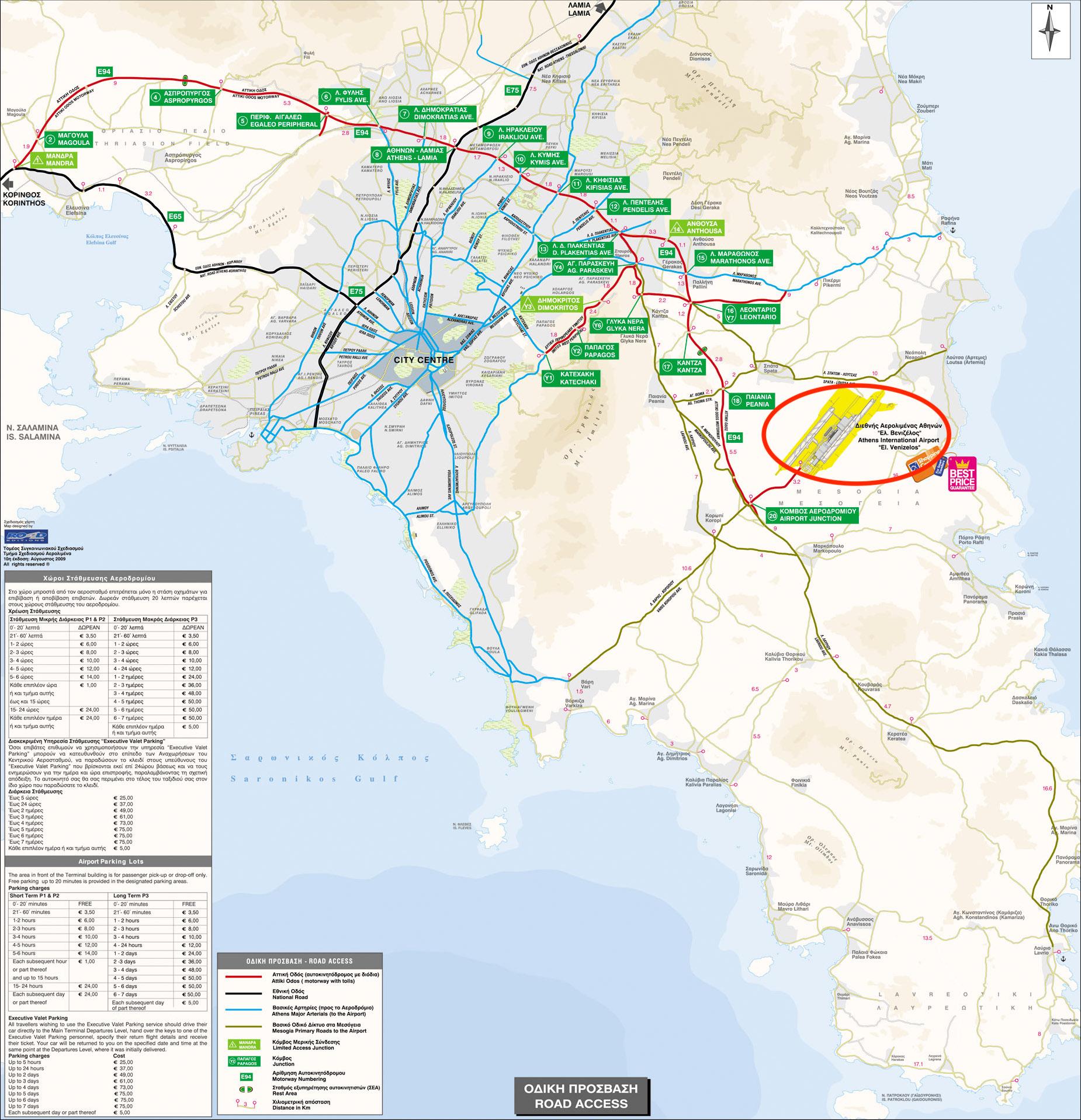
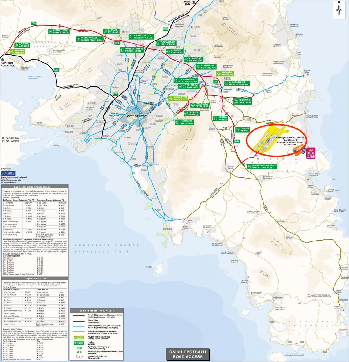
Athens is served by the state of the art Eleftherios Venizelos International Airport (AIA) located near the town of Spata, in the eastern Messoghia plain, some 35 km (22 mi) east of Athens as its shown in Athens airports map. The airport was awarded the "European Airport of the Year 2004" Award, intended as an expandable hub for air travel in southeastern Europe and was constructed in a record 51 months, costing 2.2 billion euros, and employing a staff of 14,000.
Athens airport is served by the metro, the suburban rail, buses to Piraeus port, Athens city centre and it suburbs, and also taxis as its shown in Athens airports map. Eleftherios Venizelos International Airport accommodates 65 landings and take-offs per hour, with its 24 passenger boarding bridges, 144 check-in counters and broader 150,000 m2 (1,614,587 sq ft) main terminal; and a commercial area of 7,000 m2 (75,347 sq ft) which includes cafes, duty-free shops, and a small museum.
In 2007, the Athens airport handled 16,538,390 passengers, an increase of 9.7% over the previous year of 2006. Of those 16,538,390 passengers, 5,955,387 passed through the airport for domestic flights, and 10,583,003 passengers travelled through for international flights. Beyond the dimensions of its passenger capacity, AIA handled 205,294 total flights in 2007, or approximately 562 flights per day (see Athens airports map).
The map of Athens airport presents the main international airport of Athens. This international airport map of Athens will allow you to determine by which terminal and gate you will arrive or leave Athens in Greece. The airport Athens map is downloadable in PDF, printable and free.
Inaugurated in 2001, the Athens International Airport, also known as Athens Eleftherios Venizelos International Airport, is the most important airport in Greece with over 21 million passengers a year. If you have to drive back to the airport from Athens, follow the direction signs marked “Markopoulo Airport”, as Athens international airport is known locally, because it is located near the town of Markopoulo, to the southeast of Athens as you can see in Athens international airport map.
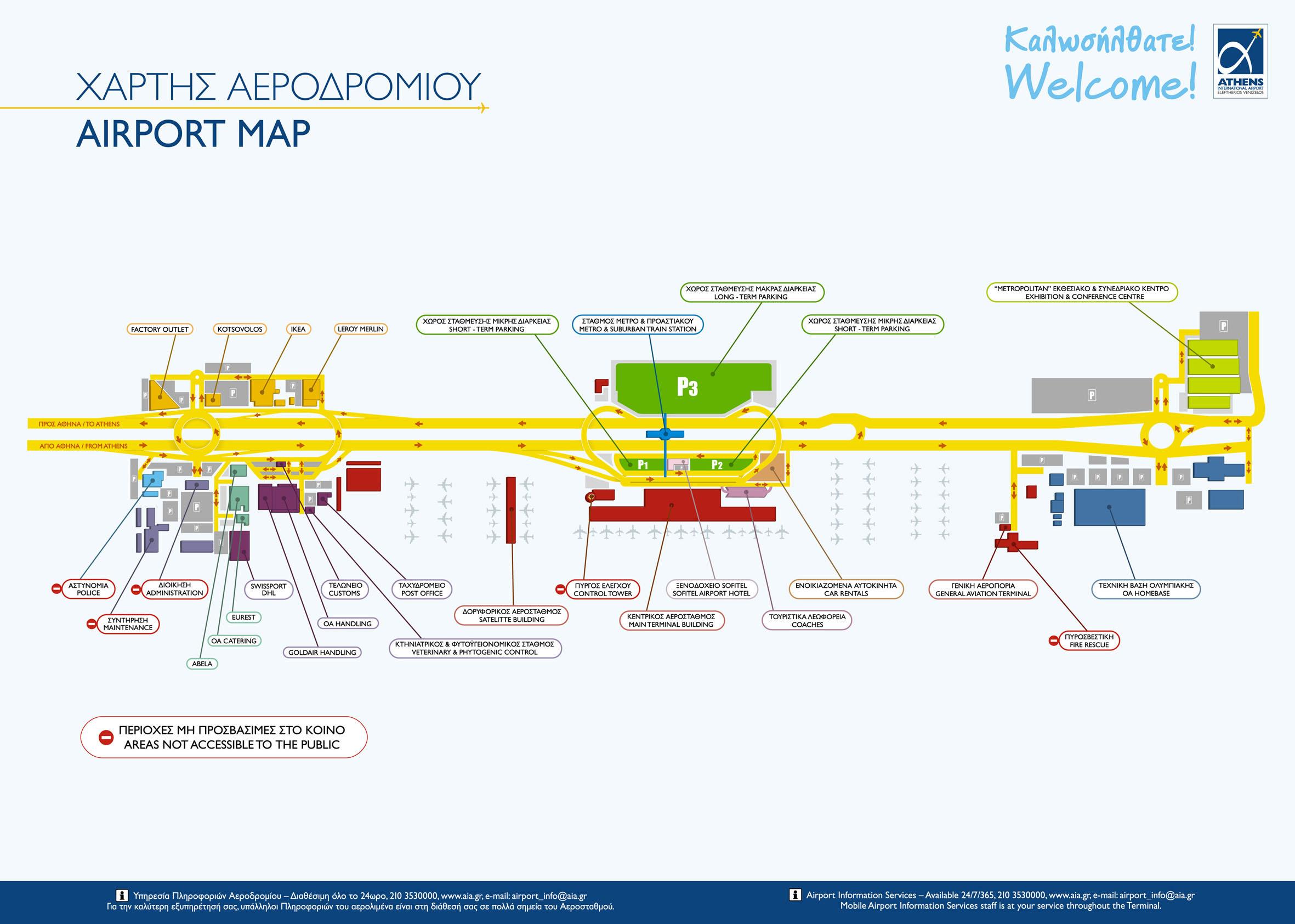
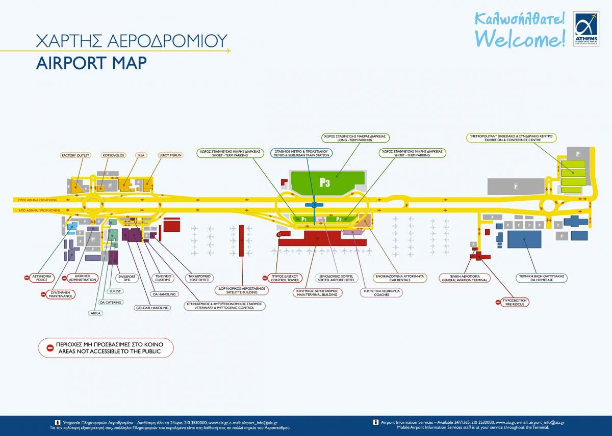
Athens international airport currently has two terminals: the Main Terminal, and the Satellite Terminal accessible by a foot-tunnel from the Main Terminal. As of 2009, a new above ground link to the midfield satellite terminal is under construction with a completion date by the end of 2010. Once completed, the complex of Athens international airport will be used as a Schengen facility. It has two runways that are each approximately 4 km (2.5 mi) long as its mentioned in Athens international airport map. The airport was developed by public-private partnership with Greece holding 55% of the shares.
P1 and P2 Short Term Parking of Athens international airport are designed for passengers that need to park their car a few hours or days. It is located at the Arrivals Level, across the Terminal building, just 2 minutes away from the terminal as you can see in Athens international airport map. P3 Long Term Parking is designed for passengers that need to park their vehicle for a long trip or holidays. Facilities are located across the Athens international airport main road (Attiki Odos) and it has over 5,800 parking spaces. The parking is just 5 minutes away by walk from the terminal.