

You can find on this page the Athens buses map to print and to download in PDF. The Athens bus system map and the Athens trolley map present the network, stations and lines of the buses and trolley of Athens in Greece.
The Athens bus map shows all the stations and lines of the Athens bus system. This bus map of Athens will allow you to easily plan your routes in the buses of Athens in Greece. The Athens bus system map is downloadable in PDF, printable and free.
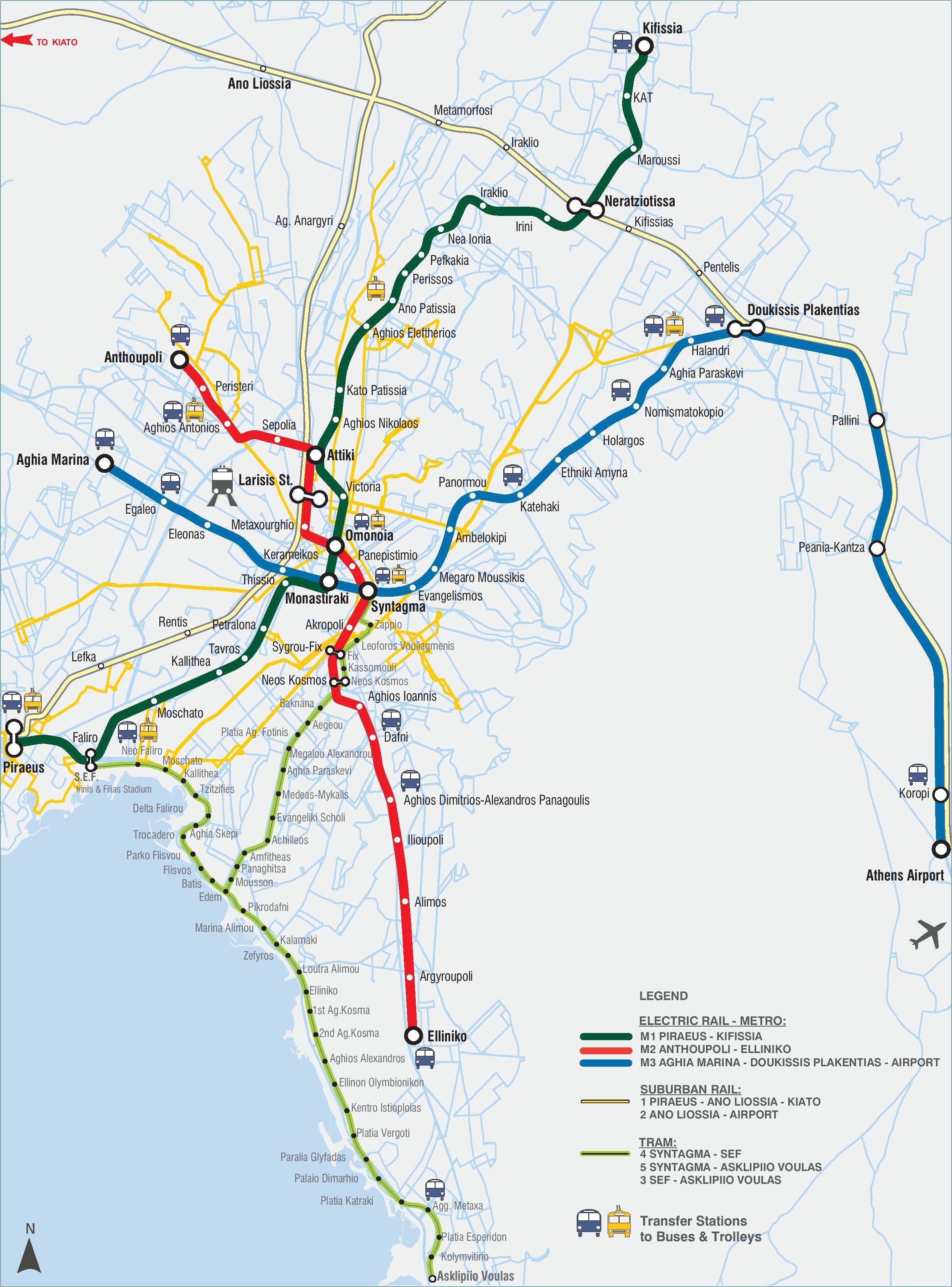
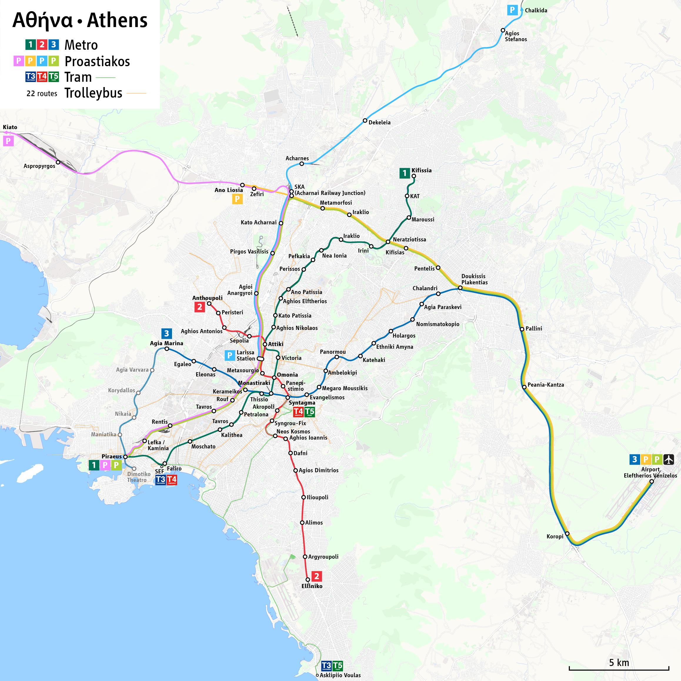
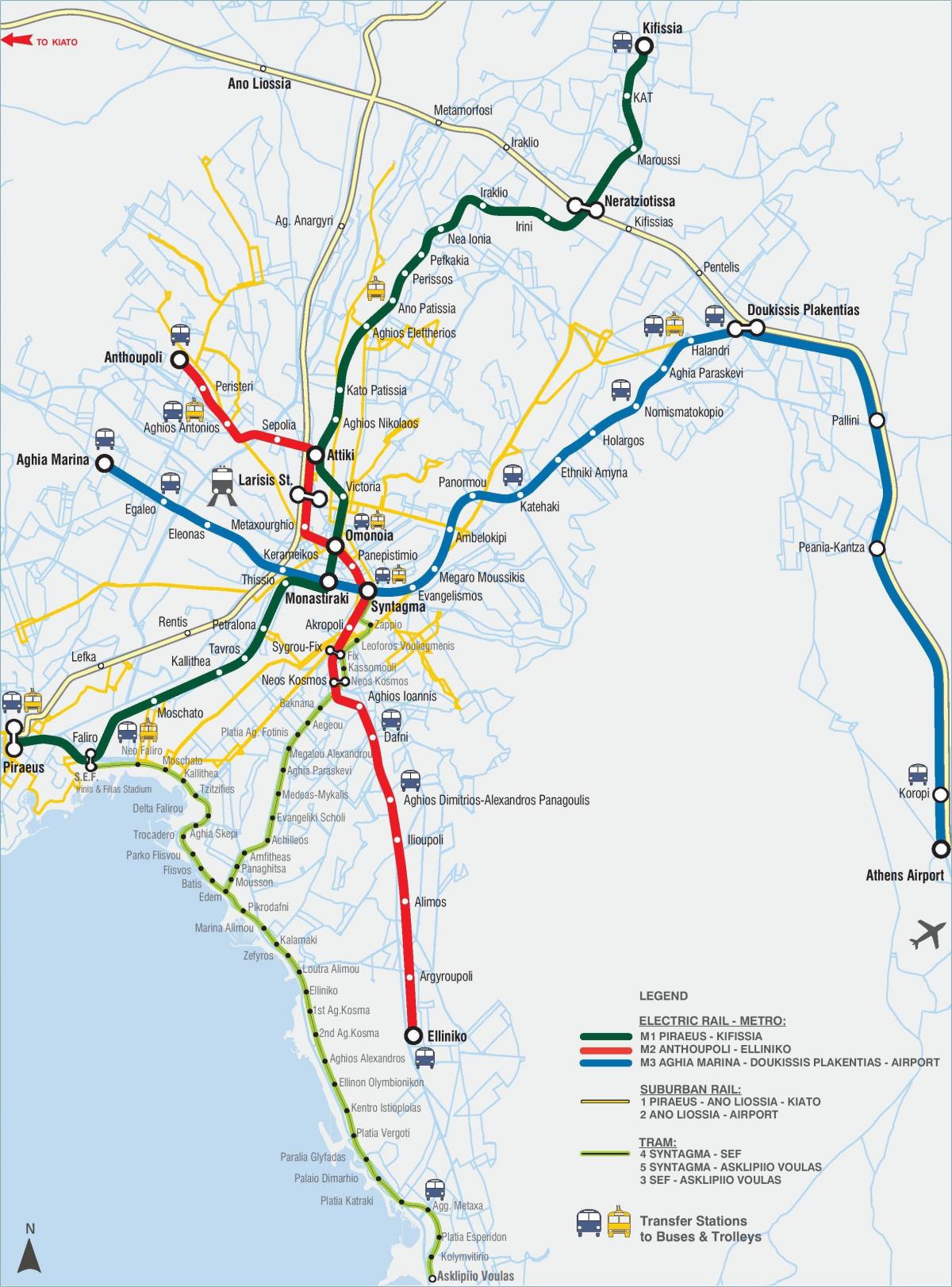
Ethel (Greek: ΕΘΕΛ) (Etaireia Thermikon Leoforeion), or Thermal Bus Company, is the main operator of buses in Athens (see Athens bus map). Its network consists of about 300 bus lines which span throughout the Athens Metropolitan Area, with an operating staff of 5,327, and a fleet of 1,839 buses. Of those 1,839 buses 416 run on compressed natural gas, making up the largest fleet of natural gas-powered buses in Europe. There are no nighttime buses in Athens, but some bus routes run 24 hours a day, and others just run on the weekends. The most important lines link Syntagma Square with Piraeus harbor and Kifisia.
If you are planning to visit the environs of Athens, the city has numerous bus lines that travel long distances as you can see in Athens bus map. These buses have their own bus stop (orange colored and marked “KTEL”). This means of transport is the most comfortable way to get to sights like Sounion cape. The KTEL buses have a different fare from the city buses. You can purchase your bus ticket directly from the bus driver.
Athens has over 60 bus and trolleybus lines that run through the city center and surroundings. They usually operate from 6:00 am until 11:00 pm, with the exception of some buses that operate 24 hours, such as the Express buses from Athens Airport to Syntagma or to the port of Piraeus as its shown in Athens bus map. Tickets for buses and trolleybuses can be bought in special kiosks around the town or inside all the Metro Stations.
The Athens trolley map shows all the stations and lines of the Athens trolleybus system. This trolley map of Athens will allow you to easily plan your routes in the trolleys of Athens in Greece. The Athens trolley system map is downloadable in PDF, printable and free.
Besides being served by a fleet of natural-gas and diesel buses, the Athens Urban Area is also served by trolley buses — or electric buses, as they are referred to in the name of the operating company. The network is operated by Electric Buses of the Athens and Pireaus Region, or ILPAP (Greek: ΗΛΠΑΠ) and consists of 22 lines as its mentioned in Athens trolley map, with an operating staff of 1,137. All of the 366 Athens trolley are equipped to enable them to run on diesel in case of power failure.
City buses and electrical trolley buses serve Athens and its suburbs. Most vehicles are air-conditioned although most of them have started showing their age. Special schedules apply during summer months of July-September. Operating hours vary according to line/day/season, but generally they run between 5:00 a.m. – midnight. There are also five 24-hour lines, 4 airport lines (see above section), and 8 Express lines as its shown in Athens trolley map.
There are many trolley buses running in the city center of Athens, they are also more crowded than the normal buses. This is interesting because in most European cities the trolley bus has disappeared as a mode of transport. In Athens the trolleybus is so popular and useful, it runs all over Athens as you can see in Athens trolley map.